Read this with minimal ads our Mobile Apps! iOS – Click Here | Android – Click Here
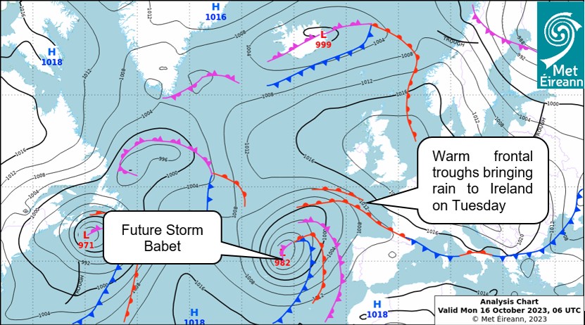
After a fine, dry and cold weekend, a change is on the way as a complex area of low pressure develops to the west of the Iberian Peninsula. This system will eventually become Storm Babet, which was named by the UK Met Office this morning (October 16th).
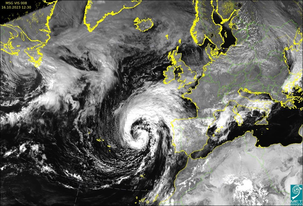
The visible satellite image shows the spiral mass of cloud off the west of Portugal, indicative of a low-pressure system, which will track northwards over the coming days.
To the north of this depression, frontal troughs will bring heavy and persistent rain northwards over Ireland through Tuesday and Wednesday. The rain will be heaviest in the south of the country.

Fig 2 : Surface Analysis chart of valid 0600UTC
The low pressure system, named Storm Babet by the UK Met Office will deepen and track northwards over England, Wales and Scotland through Wednesday and Thursday. Storm Babet will mainly affect parts of eastern Scotland, Northern Ireland and northern England from Wednesday onwards.
On Monday (16th October) status orange rainfall warnings have been issued for Cork, Kerry and Waterford, with status yellow rainfall warnings for a number of other counties (https://www.met.ie/warnings).
Met Eireann meteorologist Brandon Creagh commented that:
“A series of warm fronts, ahead of a low-pressure system are approaching the country, bringing heavy and persistent rain to the south of the country, and extend northwards through Tuesday into Wednesday with localised flooding likely.
Along with the rain, southeasterly winds will strengthen, reaching gale force along southern and eastern coasts, bringing the possibility of wave overtopping at high tide on Tuesday evening. Driving conditions will be difficult due to the combined effects of heavy rain, strong winds and poor visibility.”

