Help Support Cork Safety Alerts – Donate the price of a coffee here via Stripe: https://csalert.ie/donate
This weekend, Storm Bert will move close to Ireland, displacing the recent cold Arctic airmass. Very strong winds and heavy rain will track northeastwards over the country on Friday night and Saturday morning.
Storm Bert will continue to dominate our weather through the weekend and into early next week and further warnings will be issued for this event.
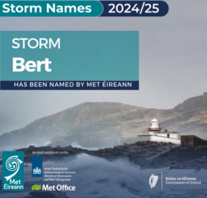
Storm Bert becomes the second storm of the 2024/2025 season, bringing another change to the weather this weekend – much wetter and windier.
An ADVISORY has been issued for Ireland, together with a number of orange rainfall and yellow warnings, starting Friday night and into Saturday.
Further weather warnings will follow.
Why have we named it? Bert is a low-pressure system currently forming in the Atlantic. When it moves closer to Ireland it will displace the current cold Artic air introducing very strong winds and heavy rain.
Potential impacts considered at the moment are:
- Localised river flooding: small upland and urban catchments are at the greatest risk of flooding, particularly in the southwest and west, since the heavy and prolonged rainfall will fall on already saturated or waterlogged soil.
- Surface flooding: snow melt on Thursday and Friday will meet heavy rainfall on Saturday
- Dangerous travelling conditions
- Displaced objects
- Fallen trees
Main impacts
are expected on Saturday and Sunday, but there’s potential for lasting impacts into early next week.
We are closely monitoring the situation and will provide updated information as Met Éireann’s high resolution model (2 days ahead) provides more detailed information.
METEOROLOGICAL SITUATION
This weekend, Storm Bert will move close to Ireland, displacing the recent cold Artic airmass. Very strong winds and heavy rain will track north eastwards over the country on Friday night (yellow wind and rain warnings issued nationwide), which will continue right through the weekend.
Figure 1 – 6 hour rainfall forecast showing heavy rain sweeping across the country on Friday night (22nd November) into Saturday (23rd November), following by heavy scattered showers on Sunday (24th November) and Monday (25th November).Meteorologist Andrew Doran-Sherlock says: “Storm Bert will bring milder but very wet and windy conditions for the weekend. Heavy rain on Saturday and Sunday will likely lead to localised flooding in urban areas and some river catchments particularly in the west and southwest, as this rain is falling on already saturated and waterlogged ground. We are monitoring the situation closely and will upgrade/issue warnings as Met Éireann’s high resolution model (which provides information 2-days ahead) is analysed. There’s strong likelihood of status orange wind warnings in western and northwestern counties. The impacts from Storm Bert will commence later on Friday and will continue through the weekend and potentially through early next week as well.”
Figure 2 – 3 hour mean winds and max gusts. The colours represent wind warning levels for gusts from Friday afternoon (22nd November) to Monday night (25th November). HOW TO STAY SAFE IN EXTREME WEATHER
- Stay up-to date with the forecast and the warnings for your county on met.ie, the Met Éireann app or Met Éireann socials (@meteireann).
- Check in with your local authority and emergency management stakeholders (Irish Coast Guards, Gardaí, etc) via their websites and social channels to see how your area will be/is affected.
- Ensure your mobile is phone is fully charged to enable communication in advance of the event and keep local emergency numbers in your phone.
- Keep a small amount of food, medical and water supplies in case it’s dangerous to step out of the home.
- Advance planning for flooding: You can consult the OPW flood maps, which show areas that may be at risk of flooding based on historical data (see www.floodinfo.ie).
- Stay away from coastal areas during the period. Remember the advice from the Irish Coast Guard: “Stay Back, Stay High, Stay Dry”.
- Don’t try to walk, cycle or drive through flooded areas, the depth of the water can be deceiving.
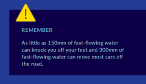
- Remember: As little as 150mm of fast-flowing water can knock you off your feet and 300mm of fast-flowing water can move most cars off the road.
- While on the road in strong winds, beware of fallen trees or other debris and high sided vehicles, particularly when overtaking. If you are driving a high sided vehicle, try to anticipate exposed sections of roadway where winds will be stronger.
- ESB Networks is highlighting the dangers posed by fallen live wires and advises the public and the emergency services to stay away from fallen cables and to report such cases immediately. ESB Emergency Services can be contacted at 1800 372 999.
- You can monitor www.powercheck.ie in regards to power restoration times
- “Be Winter Ready”: Follow recommendations before, during and after the event on gov.ie – Be Winter Ready (www.gov.ie)
NOTE THAT: The warnings are likely to be updated. Please keep in touch with Met Éireann’s social media channels, www.met.ie and the Met Éireann app to stay up to date with the forecast and any warnings’ updates. The timing and location of extreme weather occurrences can significantly affect their impact. It’s important to note that in any individual weather event, not every location within a warning area may experience the same degree of weather or impacts. When severe weather is expected, weather and impacts at lower levels are also likely to be experienced. The type and level of impacts can be strongly affected by previous weather conditions. When issuing a warning, Met Éireann takes into consideration the forecasted conditions and thresholds, as well as previous weather conditions that may increase the level of impact expected for particular areas. WHY AND HOW ARE STORMS NAMED? Storms are named when they could cause ‘medium’ or ‘high’ impacts in one of the three partner countries. This enables consistent, authoritative messaging to the public and other stakeholders to help them to prepare for and stay safe during potentially severe weather events. Since 2015, Met Éireann and the UK Met Office have been working together on the naming programme and were joined by the Netherlands’ KNMI in 2019, to form the ‘western group’ of European weather services. When a storm is forecast, the national weather service that expects the biggest impact from the severe weather to hit its region, or is likely to be first affected by it, names the storm. Storm naming happens in conjunction with orange/red weather warnings, which could be for wind, rain or snow, or a combination of these conditions. Those warnings are, in turn, issued based on a combination of numerical thresholds and the potential impacts foreseen. HOW ARE STORM NAMES CHOSEN? Met Éireann, the UK Met Office and KNMI publish a new list of storm names for each Storm Season, which commences on 1st September. This 2024/25 season, each of the three meteorological services contributed seven names to the season’s list. Met Éireann’s contributions to this year’s list were taken from more than 500 suggestions by primary school children participating in ESB Science Blast last February. The full 2024/25 list is Ashley, Bert, Conall, Darragh, Éowyn, Floris, Gerben, Hugo, Izzy, James, Kayleigh, Lewis, Mavis, Naoise, Otje, Poppy, Rafi, Sayuri, Tilly, Vivienne, Wren, with Met Éireann contributing the names for C, D, H, I, N, P and V (names chosen by Met Éireann in bold). 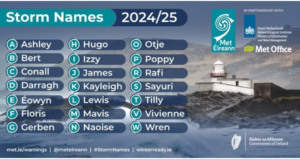 (Note – letters Q, U, X, Y, Z are not included, in line with the US National Hurricane Centre naming convention.) PAST STORM SEASONS OVERVIEW
- Last season (2023/24) there were fourteen (14) named storms affecting the area, twelve (12) of which were named by the Western Europe Group, formed by UK Met Office, KNMI and Met Éireann, and the other two (2) storms (Elisa and Geraldine) by the Southwestern Europe Group, made up of France, Portugal and Spain.
- 2023/24 was the season with the highest number of storms named in a season by the Western Europe Group list (12 storms)
- 2023/24 is the first season since the initiative began in 2015 in which an ‘L’ storm was named from the list of the Western Europe Group – Storm Lilian in August 2024.
- The lowest number of named storms since the initiative began was the four (4) named in 2022/23.
- Prior to the 2023/24 season, the highest number of named storms occurred in the 2015/16 and 2017/18 seasons, with eleven (11) named storms in each.
- Since 2015/16, there has been an average of eight (8) named storms in each season
- Season 2015/2016 remains the season with the greatest number of storms reaching Storm Force 10, as nine (9) of the eleven (11) named storms observed Storm Force 10 sustained wind speeds at Atlantic coastal stations.
- During the past season 2023/24, there were three (3) named storms with Storm Force 10 sustained wind speeds or higher:
- Storm Force 10 sustained (10-minute mean) wind speeds were observed during named Storm Fergus (91 km/h) and Storm Jocelyn (96 km/h), at Mace Head (coastal), Co Galway on Sunday 10th December 2023 and Tuesday 23rd January 2024 respectively.
- Violent Storm Force 11 sustained wind speeds were observed at Mace Head (coastal), Co Galway during Storm Isha on Sunday 21st January 2024. Before that, Violent Storm Force winds had been last observed during Storm Eunice on Friday 18th February 2022.
- No Hurricane strength sustained/mean winds at any Met Éireann wind station have been observed since the Storm Naming initiative began. Storm Ellen in August 2020 came very close to observing winds of this strength, with 111 km/h at Roches Point, Co Cork. The last hurricane force winds affecting Ireland were observed during Storm Darwin on Wednesday 12th February 2014. Hurricane force winds have been observed at coastal western stations, mainly in January (half the time), twice in December and once in February, March and September.
- It is not uncommon to have storms named in the month of October. Since the naming initiative started, 5 out of 9 seasons have had October storms, including Ophelia on 16th October 2017 and Babet last year. Prior to storm Ashley, a total of 7 storms have impacted Ireland in October, since 2015.
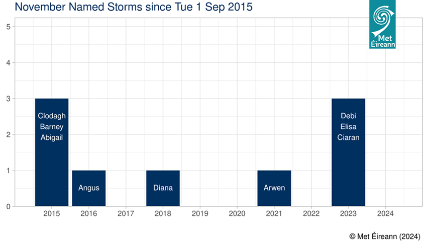
- November storms: It is not uncommon to have storms named in the month of November. Since 2015 when the naming initiative started, 5 out of 9 seasons have had named storms in November. Since 2015, the maximum number of storms affecting Ireland in the month of November is 3, which happened in 2015 and 2023, with Debi, Elisa and Ciarán.
For more information on storm names and past storms, see Storm Centre and Major Weather Events

